
by JRobins | Mar 16, 2025 | Announcement
March 2025 Announcements Exhibits, Events & More LAST CHANCE TO SHARE. There is still time to add your memories to the Clover Club display. Look for a contest drawing to win a Mr. and Mrs. Potato Head play set. Forms will be available for pick up at the display...
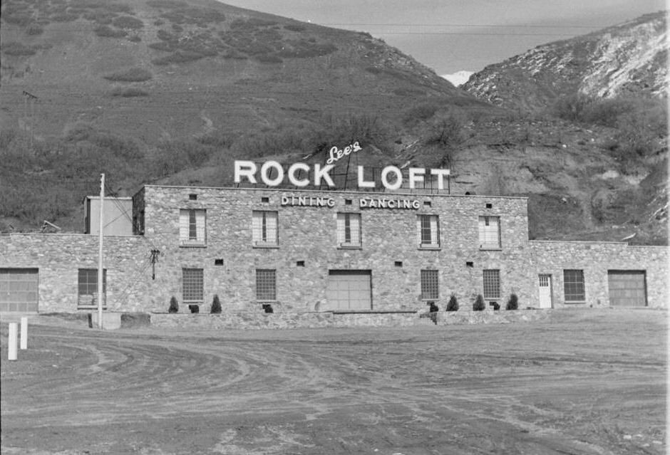
by JRobins | Mar 1, 2025 | Historic Marker
Bair Canyon Enterprises HISTORIC MARKER 251 S. Mountain Rd, Fruit Heights, Utah – (Rock Loft)41° 01′ 54.5″ N • 111° 54′ 07.2″ W The Bair, Raymond, and Green pioneers gravitated to the land near the mouth of Bair Canyon. This canyon...
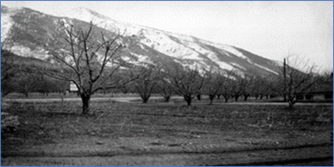
by JRobins | Mar 1, 2025 | Historic Marker
Ward Orchards And Brickyard HISTORIC MARKER 470 N. Mountain Road, Fruit Heights, UtahJust North of the 400 North Overpass41° 02′ 31.8″ N • 111° 54′ 33.5″ W After the Samuel Ward family established their first log home above Kaysville, they...
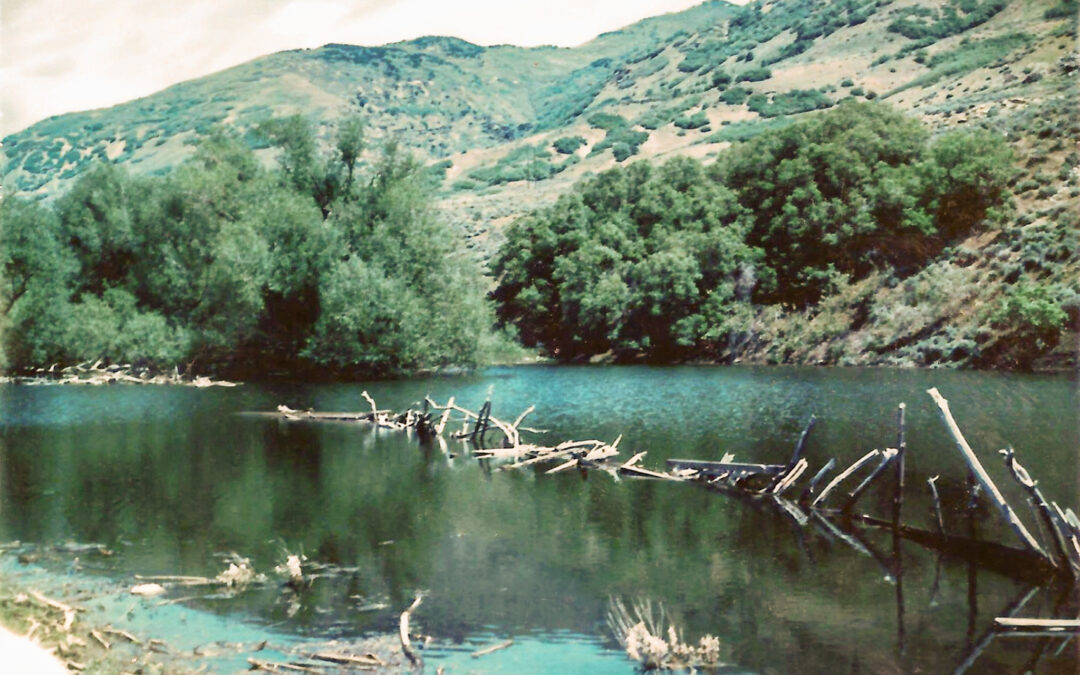
by JRobins | Mar 1, 2025 | Historic Marker
Harvey Pond HISTORIC MARKER 910 S. Mountain Rd, Fruit Heights, Utah – (Harvey Park)41° 01′ 14.5″ N • 111° 54′ 23.6″ W Between 1863 and 1870, Daniel and Hannah Smuin Harvey acquired approximately 360 acres of mostly steep, rocky,...
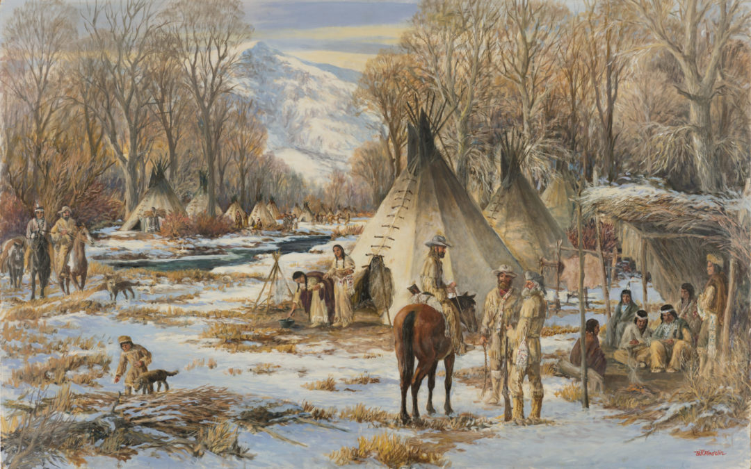
by JRobins | Mar 1, 2025 | Historic Marker
Trappers Winter Camp HISTORIC MARKER 701 E. Nicholls Rd. Fruit Heights, Utah – (Gaily Trail parking lot)41° 01′ 20.8″ N • 111° 55′ 27.0″ W Atypical over-wintering settlement strategy utilized by Rocky Mountain fur trappers in the...