Virtual Tour
PRESERVING THE PAST FOR THE FUTURE
OLD TOWN CENTER STREET
Kaysville Center Street Walking Tour
600 East to Main Street
Small tours of historic Kaysville sites first took place around 1970 under the instigation of Carol Ivins Collett and Ivy Bishop Harvey. Much of the research was conducted by Alpheus Harvey. Bus tours were one of many activities planned as part of the Kaysville – Fruit Heights Bicentennial Celebration of the United States in 1976. As a result of the researched tours by the Collette-Harvey team, a book was published as a “Bicentennial Community Project” titled Kaysville, Our Town: A History and included details about the historic homes. Homes in the book were photographed by Robert (Bob) Arthur Anderson.
After the bicentennial year, the Daughters of the Utah Pioneers in Kaysville sponsored the bus tours. Roselyn Slade, who along with J. Forest Barker, Stephen Whitesides and Danny Phelps comprised the bicentennial history committee, took over managing tours when Carol passed away in 1983. Members of the D. U. P. became guides. According to a 1987 Self-Guided Walking Tour Number One publication, usually four one-hour tours were completed before the parade each 4th of July. Because “the buses were full and people were sometimes turned away,” the D. U. P. ladies decided to create a walking tour to be undertaken with family groups or individually by citizens carrying the printed guides.
In March of 2008, Kaysville City employed, Shirley Mills compiled the booklet Kaysville Historic Tour. It was in a pictorial THEN and NOW format. For some time it was online as a virtual tour hosted on the city web site. This tour is dedicated to those who kept our historic memory alive with tours in the past. The descriptions borrow heavily from those previous booklets.
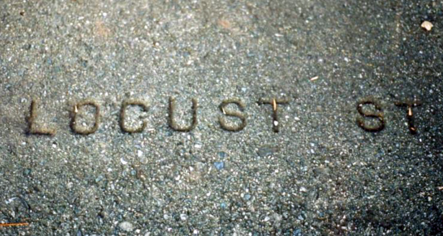
This 2020 tour takes the traveler west down Center Street or Locust Street as it was originally known. Each of the city streets described in this pamphlet are referenced as they are currently named rather than the original designations. Example: Main Street was formerly Seventh Street and 100 East was Eighth Street. The tour may best be started by car on 6th East and then, after parking, proceeding on foot from the elementary school.
NOTE: Most homes mentioned only describe one or two occupants, usually the oldest, many more families lived their years and raised their families in each. There are so many, that their stories cannot be told here. We apologize, but this history extends to about 1950 only. Oh, the stories those bricks could tell! Each tour pamphlet produced during 2020 will include a suffragist sketch in honor of the Better Days 2020 Celebration. Kaysville has been designated a HERitage City.
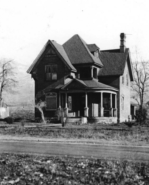
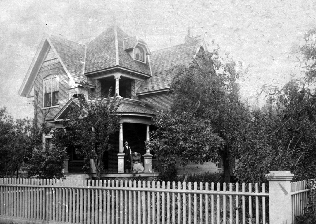
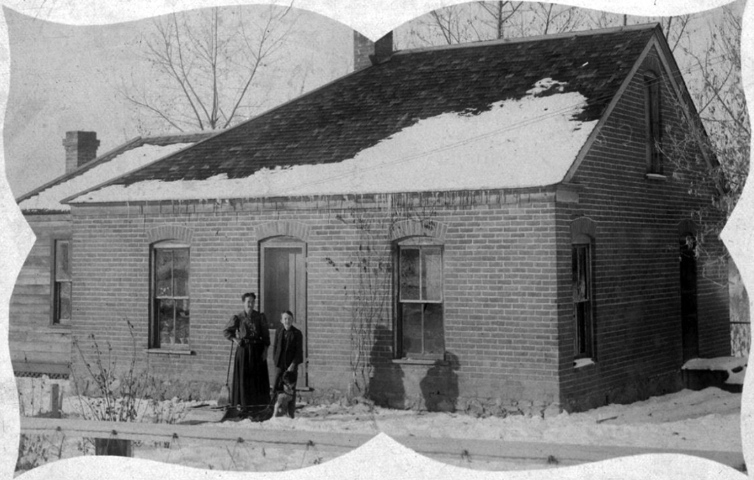
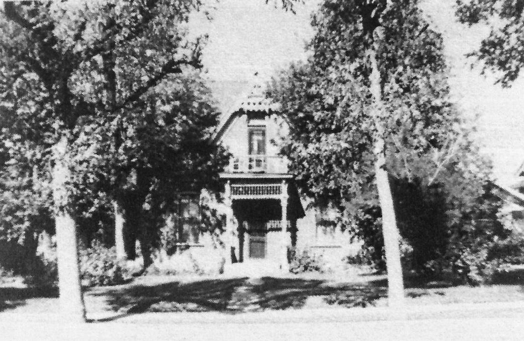
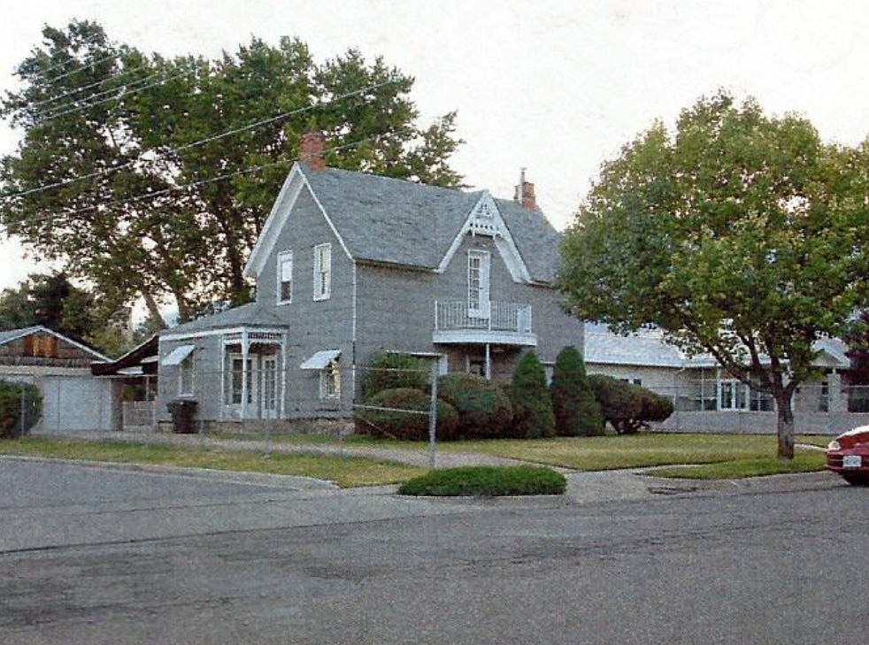
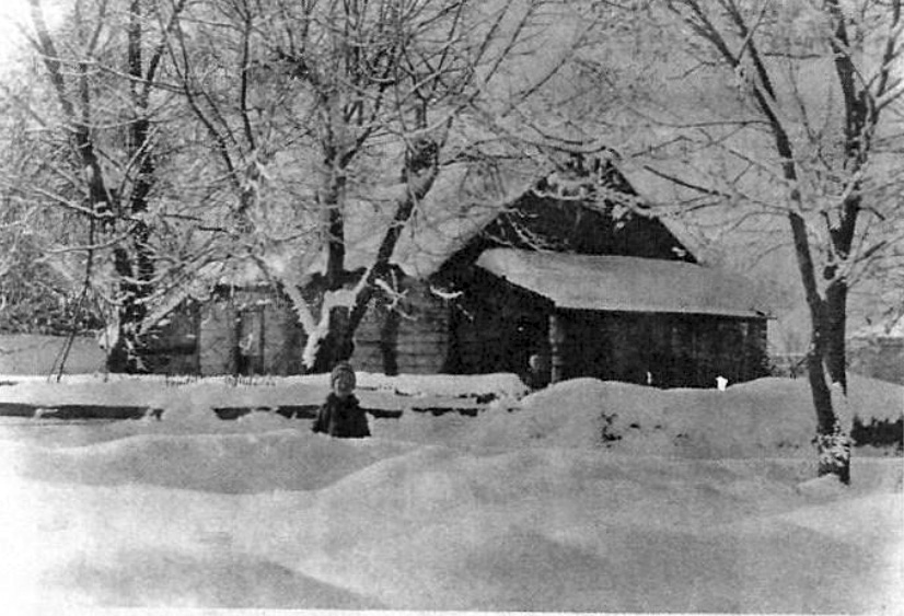
Bone Home
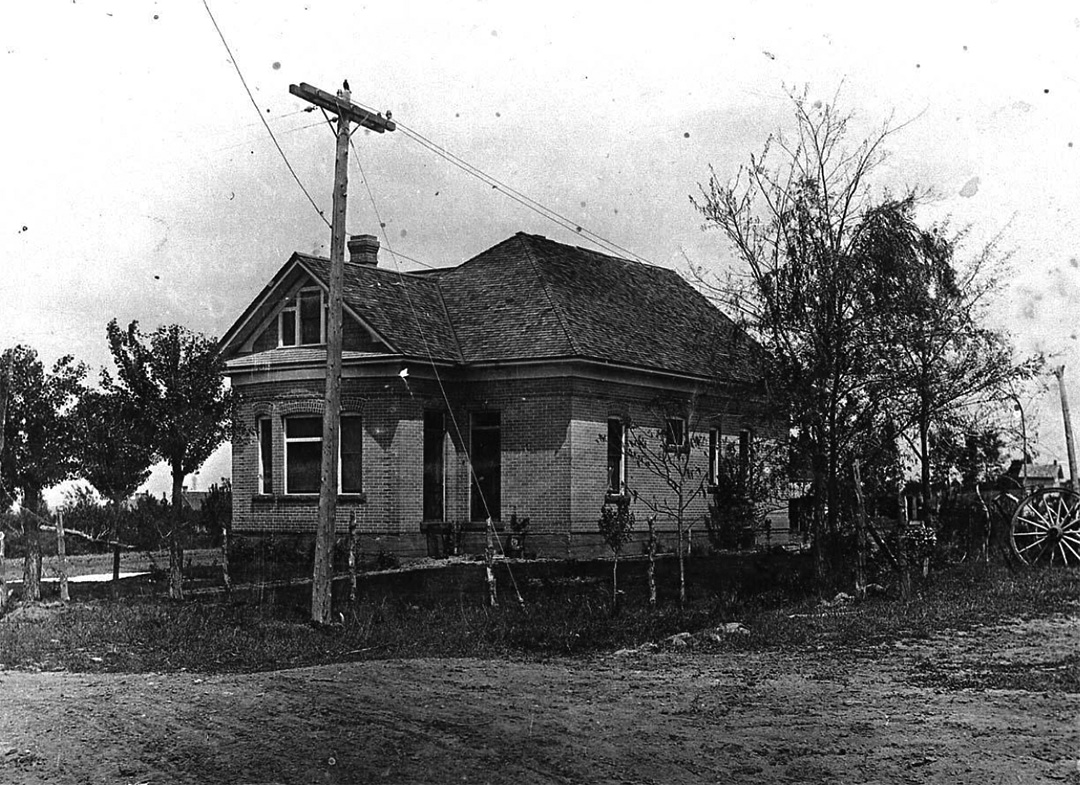 It was constructed out of yellow brick probably from the Kaysville Brickyard that was in operation from 1908-1920’s. The construction was done especially for Thomas Henry and Sarah McLeane Bone. (LR)
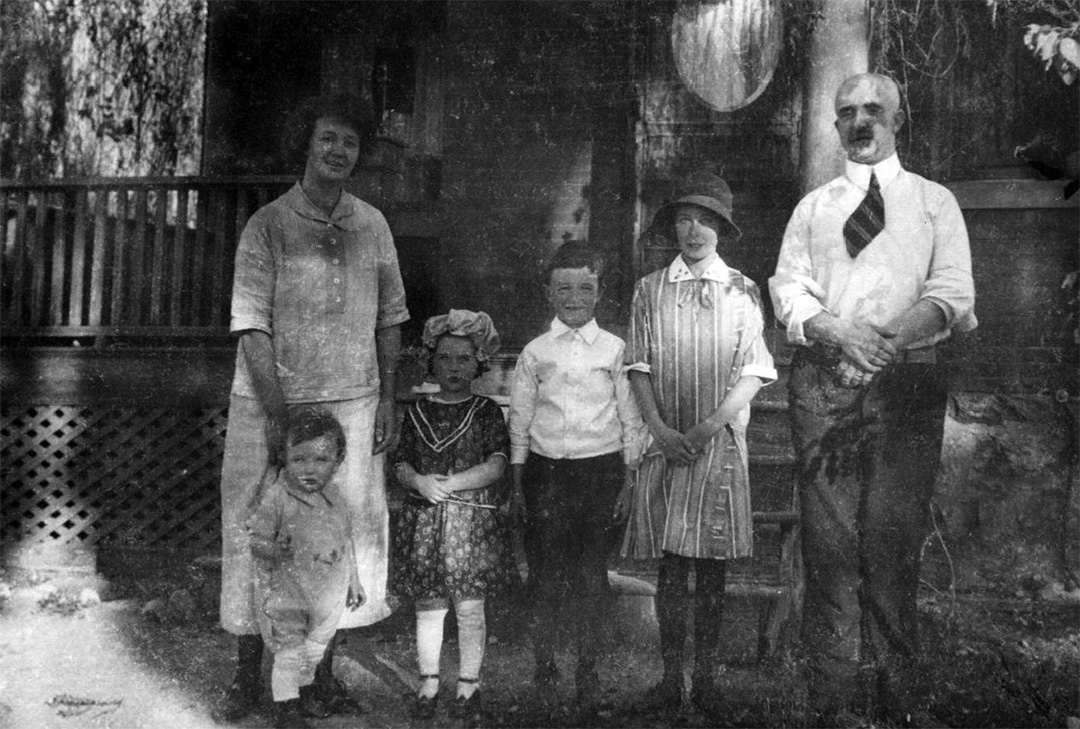
When Corilla Bone and Ivan Sessions were married in 1916, the newspaper stated that they had a reception at her father’s home on Locust Street. The couple later made their home here. (DRJ)

Notice the detail on the brick work in the photograph below, taken in the 1930s, shows Corilla, Ivan and their daughter also named Corilla. Corilla the younger married Bob Anderson who collected many of the historic photographs used in the tours.
 (FS) (KFHM) (BA)
The Barrett – O’Neil Home
The next stop is the corner of 4th East and Center where Benjamin Barrett (city councilman 1910-1912,) mining engineer, built his home. He lived there for a few years and then sold it about 1916 to Z. Henry Jacobs (city councilman 1918-1920.)
When Charles and Annie Hobson O’Neil came to Utah from Yorkshire, England, they lived for a couple of years in Salt Lake City and then came to Kaysville. They purchased this house and the “whole block of land – 6.4 acres, seven room brick building and 100 producing fruit trees – for cash,” moving in July 1922. (FS)
The photo above shows Annie, children: Kenneth, Dorothy, Charles Brian, Kathleen, and Charles P. in front of the home. Notice that the original color was a red/orange brick with white trim and porch railings. It looks nice in blue, too.
(FS) (KFHM)
William Allen Home
 Starting at Center and 300 East, is found the former home of architect William Allen. Although it has been added to, the front is essentially the same as when it was built. William Allen was an active architect from the 1870s when he acquired the property this home sits on until at least 1918 when he designed the old Kaysville Public School, now Kaysville Elementary School. (KOT)
 William Allen learned architecture by correspondence, but he graduated with high honors and his style is very distinctive and enduring. Many beautiful old Kaysville and Layton homes and businesses are indebted to him. The small brick building in back was his studio where he drew the architectural plans. People who remembered him, recalled him sitting in his studio playing the violin. Others recalled that he donated some of his services, making it necessary to lay brick on building projects as a side job. The Utah Historical Quarterly published by the Utah State Historical Society honored this man in their Winter 1986 edition. (DCC DUP) (CEM)
 (HM) (KFHM)
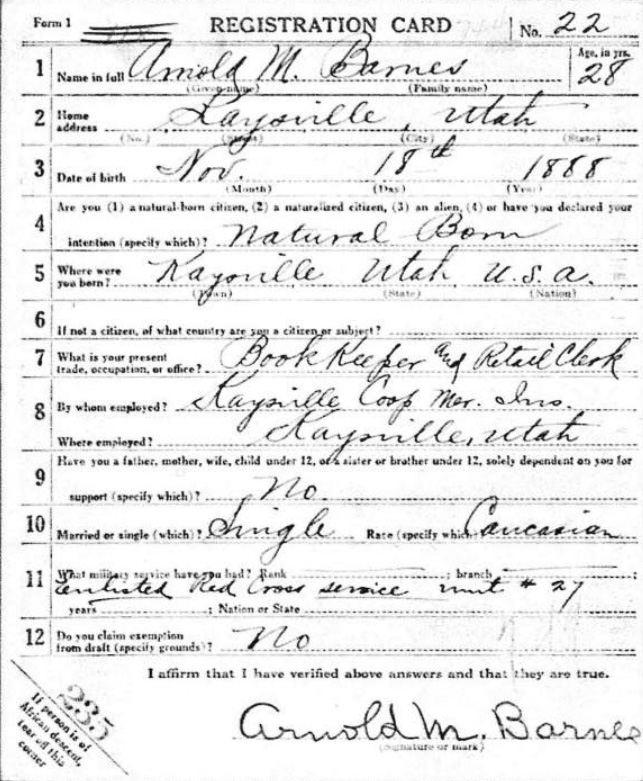
Barnes Home
 Purchased by Arnold and Jesse Barnes in 1918, the home was probably built around the turn of the century. The original had cream colored stucco construction, hard wood floors and 12 foot ceilings. A root cellar was located in the back, a common practice for the time, where the family’s fruit and vegetables were stored. A large addition has been constructed on the east, but the original home is still in place, although covered in siding.
 Arnold was a bookkeeper for the Barnes Canning Company. He used to walk to work when the canning company was located in the west part of town near the Deseret Mills. A veteran of World War I, he served with Captain Sprague’s Red Cross ambulance company in the Army Medical Corp. He registered on June 5, 1917 and served on the field in France. He was a charter member of The Elmer Criddle Post 82 of the American Legion.
Arnold and Jesse’s daughter Ruth and her husband Howard Darr lived in the home with their children, continuing after her parents.
 (KFHM) (LR) (Fold3)
Swan Home
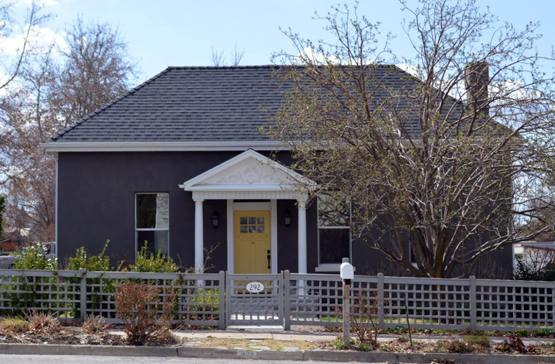 At the intersection of 3rd East and Center is situated a dark gray stucco at 292 East Center Street on the southwest corner. The original adobe part of the house was built by George Swan, Sr. (city mayor,) circa 1860’s or 70’s. He was one of the board of directors of the Utah Central Railroad. He died in 1899 and his son George Swan Jr. (city councilman,) and his wife Mary Ann Layton took over the home. After they died, their daughter Irene Swan lived there until her death.
Irene worked as a city recorder for Kaysville. She served in this position for 12 years during the 1940s and 50s. The notice printed in the newspaper refers to an ordinance set by the city to regulate the sales of poppies on May 24th, National Poppy Day. Wearers demonstrated honor for the sacrifice made by veterans while protecting our freedoms.

Fun Fact: At one time, T. McClure Peters surveyed the distance between Kaysville and Ed’s Peak. The starting point for distance and elevation measurements was at this house.
Kaysville 2nd Ward L. D. S. Chapel
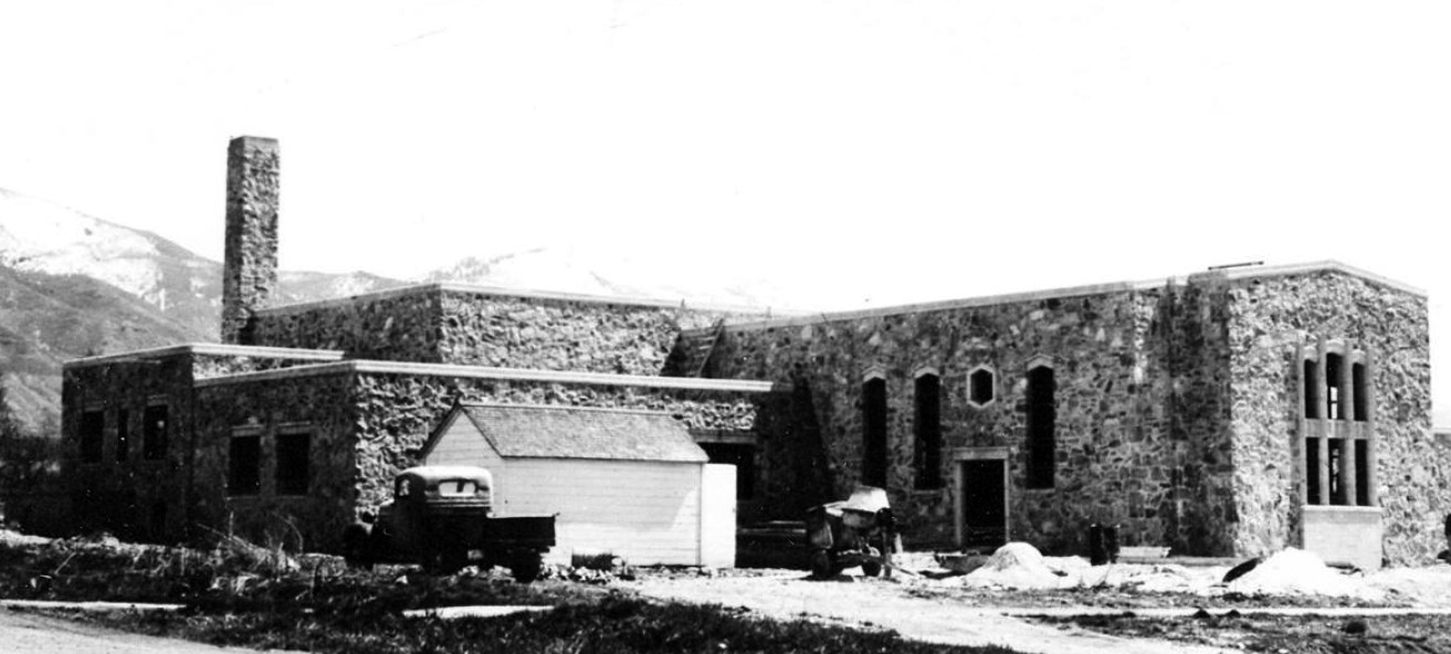 Rock Chapel under Construction
One block south on the southeast corner of 200 East and Center Street the Second Ward Chapel is located. Settled in 1850 by Edward Phillips and John H. Green, Kaysville was first named Kay’s Ward in honor of the first bishop called by Brigham Young to shepherd the small flock of settlers. Kay’s Ward was known as Freedom January 1858 to June 1863, but with Young’s disapproval soon reverted in name. The ecclesiastical designation was Kay’s Ward for some time. When the city was incorporated in 1868, the civic name became Kaysville.
At settlement, one L.D.S. ward existed in Kay’s Ward encompassing what is now Kaysville, Layton, West Point, Syracuse, Clearfield, Clinton and Sunset. As a result of growth and division of the original Kaysville (Kay’s) Ward, the Second Ward was established in 1940. The first meetings of the ward members were held in the Kaysville Elementary School Gymnasium while the new building was being constructed. The general chairman of the project was Junior J. Bowman who oversaw design by the Ashton and Evans architectural firm – Ashton was a ward member – and construction. It was designed and constructed much like the old rock city hall on Main Street. (KFHM) (HM)
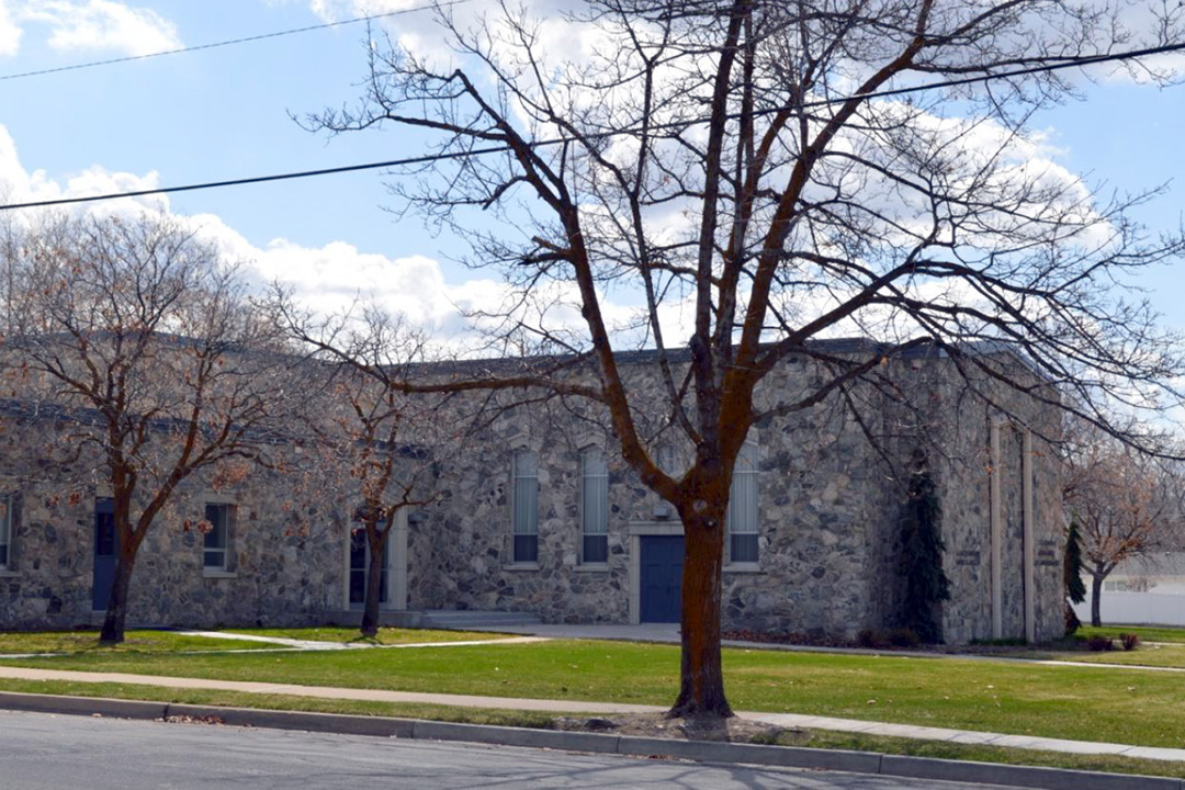 Often called the Rock Chapel, church members donated labor to haul the native stone from the foothills and canyons of the nearby mountains and to construct the building stone by stone. Due to World War II shortages, there were many delays in completion. The Second Ward Chapel was dedicated in December of 1948.
The building has unique features. The formal garden – photo clipped from the dedicatorial program was not found in most denominational chapels of the time. The massive pipe organ was not inaugurated until 1950. Albert Schreiner, renowned organist, played a concert to commemorate its completion. (KHT)
Layton - Drakos Home
 Across the street, looking west to 2nd East can be seen the home on the southwest corner of the intersection. It was built by Ezra Layton sometime between 1880 and 1890. He sold it to his niece Louise Swan Yaunt. The house was originally a two story with one bedroom upstairs, then remodeled into a complete two story building. Originally it was just a square structure made of purple stone bricks; gradually changes were made and additions completed. At one time the Swans owned much of the entire block. Louise lived there until 1936 when it was sold to Louis Drakopolous.
Louis stowed away on a ship from Greece to America at the onset of WWI because his mother insisted he flee to safety. He was 15 years old spoke no English and had no money, instead filed papers as a refugee. He changed his name to Drakos, met and married Mary Katherine McMillan and moved from Minnesota to Farmington, then Kaysville.

Having first lived in a Harvey home, the Drakos family settled into this home. There was a lot of prejudice in those days, but they persevered. In his son George’s time, a warehouse for onion crops was just to the south of the house. Both Louis and George hybridized seed – they held the first patent for sweet onion seed grown on farms in West Kaysville where lots of local kids worked. Those farms were sold to Joe and Ann Hill. (HM) (KFHM)
Boynton / McLatchie Home
 Walking west to the end of the block stop to view the Thomas Boynton home built in the 1870’s. Thomas moved to Kaysville in 1858 and worked for the Weinel Mill, then later the Layton Mill before he became a murder victim. He was one of the principal owners of the mill.
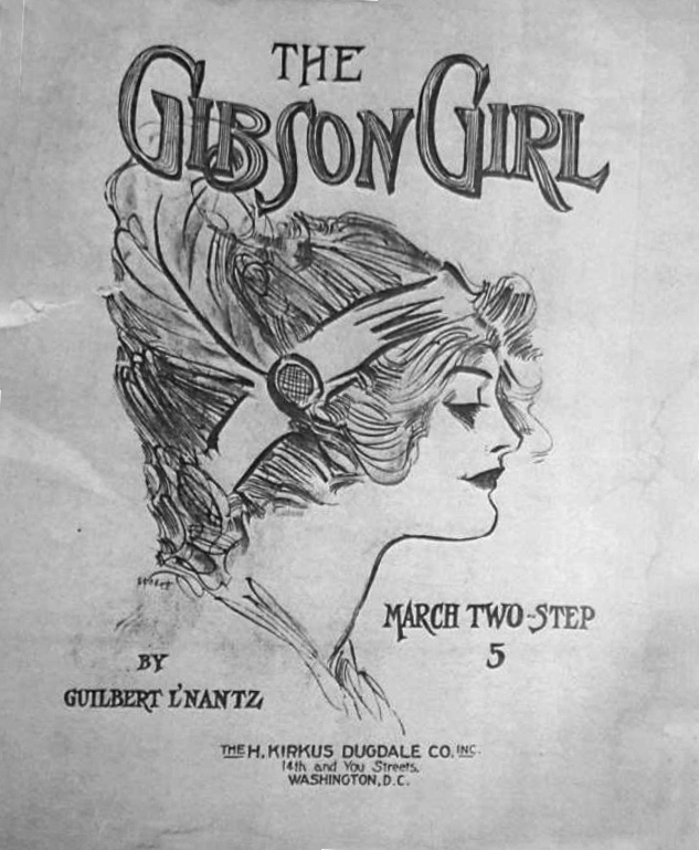
The Edmund McLatchie family are the next known inhabitants. Edmund’s daughter and son-in-law, Gilbert and Merritt McLatchie Nance, raised their younger children in this house. Subsequent to their marriage in about 1914, the two lived in several places. Their first was an adobe house on the corner of second east and first North. They lived for a time in Delta and Duchesne, but returned to Kaysville.
After Gilbert died, his widow Merritt and her sister Maud conducted the summer recreation on the school playgrounds in 1943. This took place conveniently across the road north of this home. “In the center of the area stood a small cement pool which was filled and emptied every night,’ making it possible for swimming lessons to be taught. Dancing, rhythm band, hand crafts were conducted. At the end of the season a big program, a downtown parade and exhibit showed off the (FS) (KFHM) children’s accomplishments. Kaysville had a swimming pool once!
Gilbert was musically inclined. Notice the song that he wrote with the cover pictured below. His name is spelled a bit differently from the more usual Gllbert L. Nance. c1912 (HMM) (FS) (KFHM)
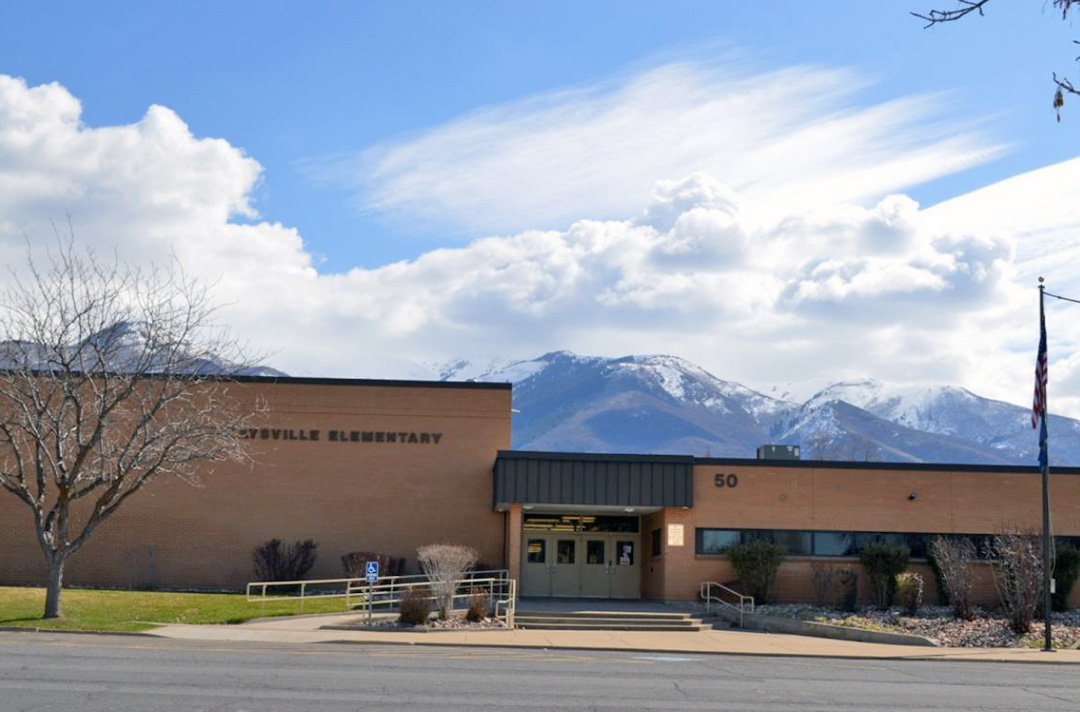
Kaysville Elementary School
While you are still on this corner, look to the north and east. Kaysville Elementary at 50 North 100 East has been replaced by a long, modern-appearing school, but on this block in 1877 was built a one-room school house, the first structure in Kaysville used only for a school and also the first to be built by taxation.
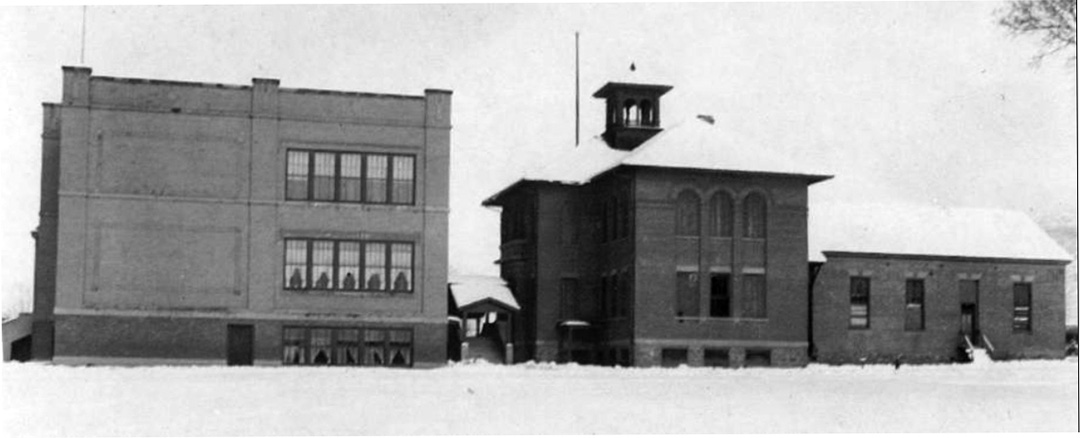 Photo of 1918, 1905 and 1877 elementary schools side by side.
In 1905, an addition was built, four rooms above ground and two in the basement. In 1918, an imposing structure designed by William Allen was built – an eight room, two story school which was later attached to the 1905 school with more classrooms and still later a south wing. For a time, all three schoolhouses stood together.
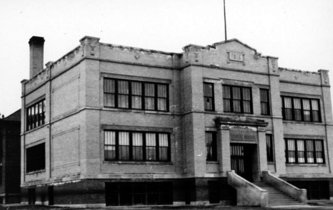
The school and schoolyard did not always cover the entire block. The Christopher Burton home was on the south side of the current parking lot and the John Barker home was situated on the south side. This school was demolished in 1985 and a completely new building erected. (DCC DUP)
 (BA) (KFHM) (HM)
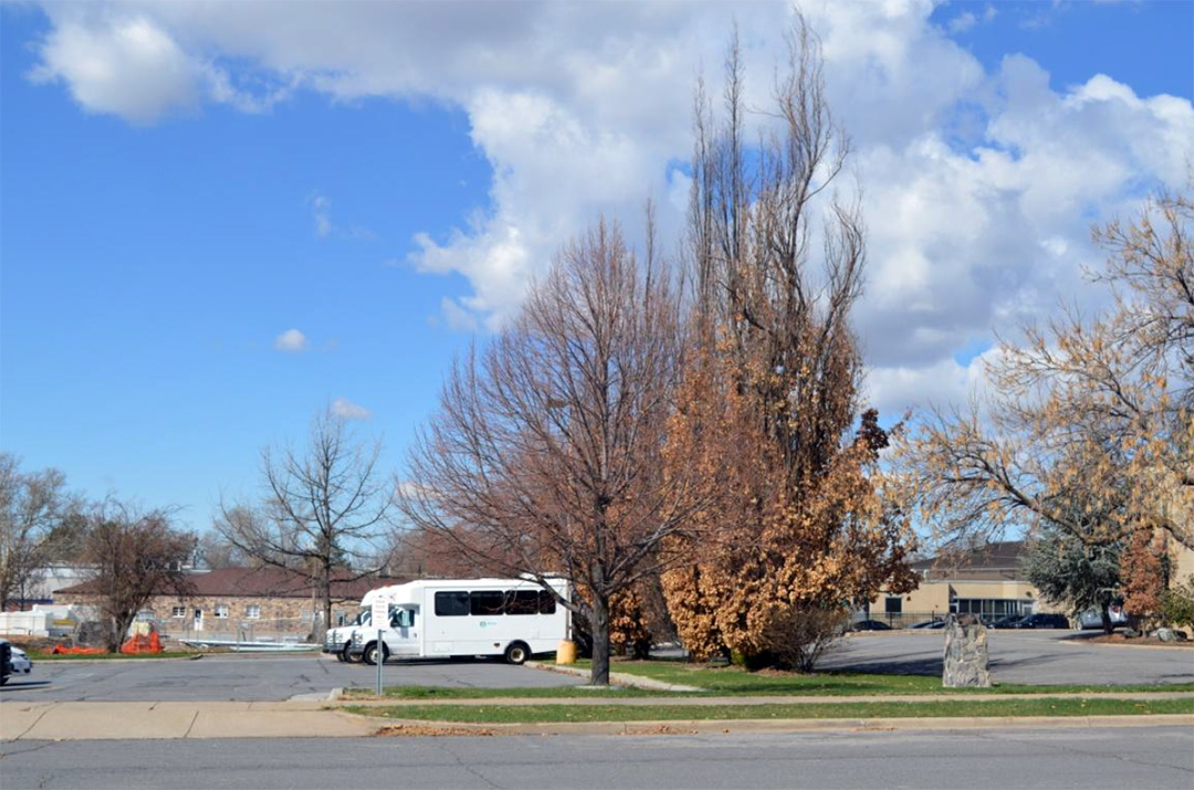
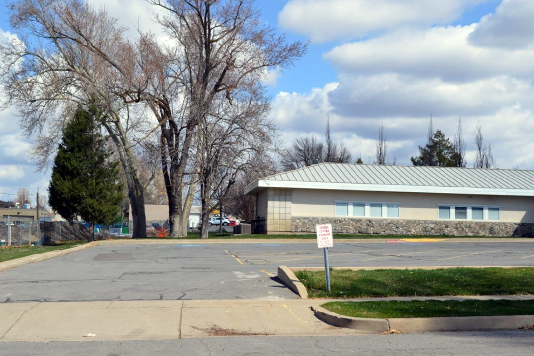
Bamberger Rail Station
 Looking across the street west from the elementary school, try to image a railroad station at 45 North 100 East, standing between the current Parks and Recreation building and the Senior Citizens’ Center. If you’ve ever wondered why 1st East is so wide, it is because the Bamberger Electric Railway Line ran along the street. For fifty years, this railroad served the people of Kaysville. The Bamberger train did stop in Kaysville before 1920, but passengers needed to buy their tickets out of Mrs. Lewis’s house which was about in the middle of the block. She later moved to Main Street and started an ice cream parlor
The depot was built and dedicated in January of 1921 and stood about where the monument now stands, south of the current city parks and recreation building. The last passenger service was in 1952 and the last freight service in 1958. (DCC DUP)
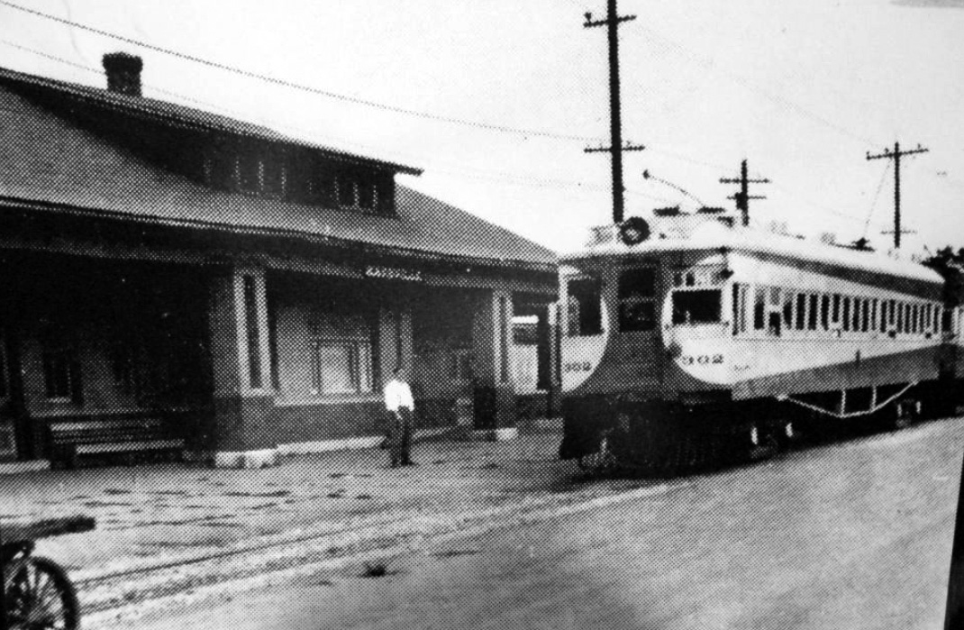 The building was torn down a few years later. At the time of demolition, the dark purple colored bricks from it were salvaged by George Tippetts. He used them to build another house in Kaysville. (HM) (KFHM)
Presbyterian Church
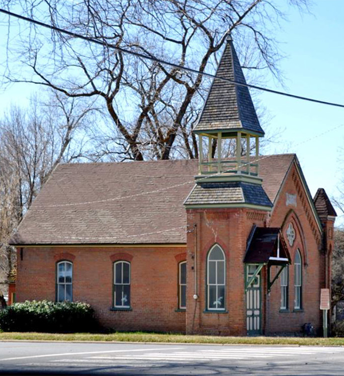
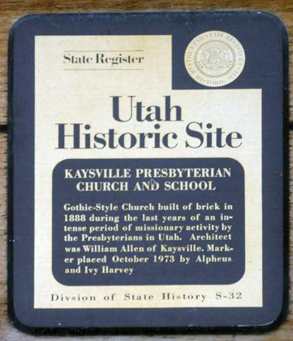
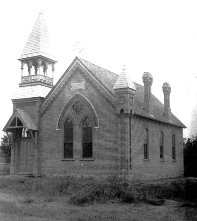 Further west on Center at First East stands a lovely, little, mellow red brick church built by the Presbyterians in 1888 was given the name Haines Memorial Church. Here had been an earlier adobe schoolhouse near 80 East Center, just to the west. The church building also served as a school, sometimes with overflow classes from the Public School across the street. Ella McDonald was the first teacher before it became a church. She bought a two bedroom adobe home that may have been where the parsonage is now (See location #11.) Reverend Knox was the first pastor of the church. Over the door is a State Register plaque. (KOT) (DG)
 Caril Home, the house just west of the church was built as the parsonage. (DCC DUP) Both Haines Memorial Church and Caril Home were thought to have been named after principal donors to their construction, most likely from the east.
The church was designed by Kaysville architect William Allen and is thought to be one of his earliest public buildings. It was one of 51 church-run schools established in Utah as part of Presbyterian Church missions in Utah and the West from 1865 to 1890. (DG)
 (HM) (KFHM)
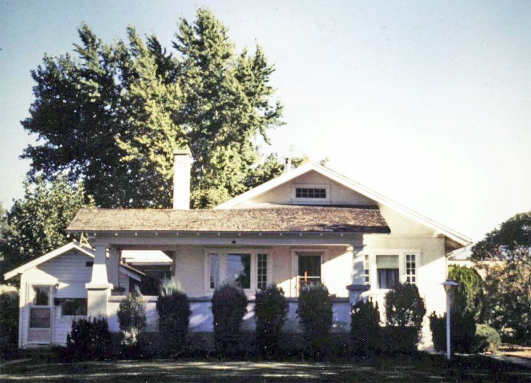
Church Parsonage – Harvey Home
 West of the Presbyterian Church is situated the parsonage for the church reverend and his family or Caril Home as it was first designated.
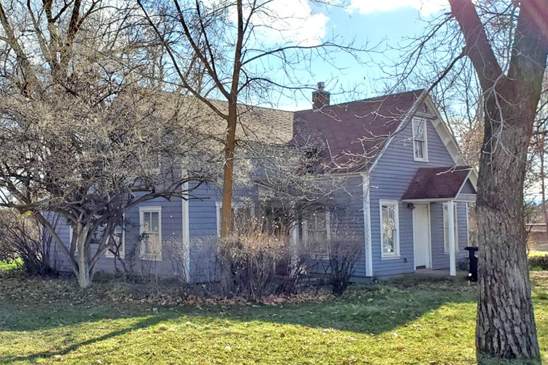
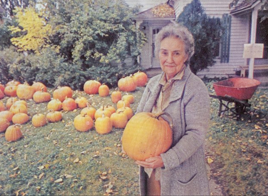
Ivy and Alpheus were known as local historians with a deep knowledge of the area so it was fitting that they purchased the church and parsonage. During the 1970s, Ivy was noted in the newspaper as “the pumpkin lady” who sold the seasonal vegetable from her front lawn. The business was entirely self-service with pumpkins grouped by size near a pricing sign. She allowed customers to select their own pumpkin and place money in a box – she simply expected honesty.
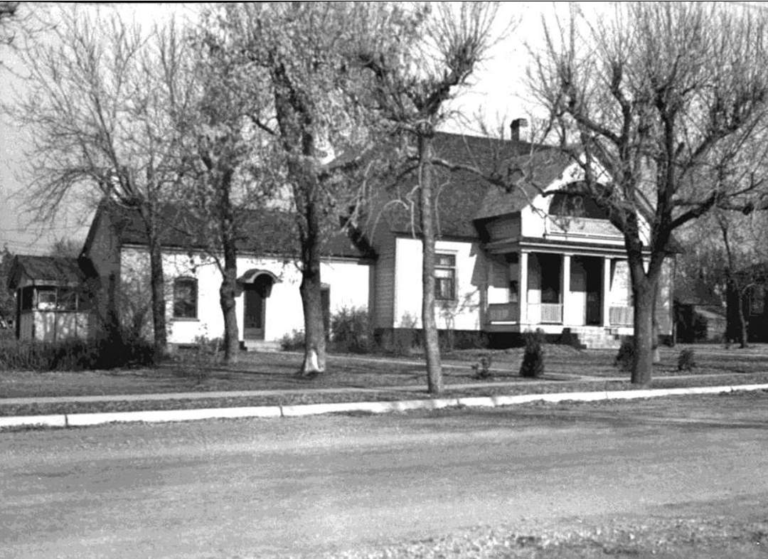
Rutledge – Davis Residence / Office
 Across the street to the south was once found “Doc” Rutledge’s home and office. The Rutledge building was designed by architect William Allen and built in around 1913.
The north side of the block between Main and 100 East might have been named Medical Block in the past with two doctors and a hospital found in close proximity. Rutledge was a well-known doctor, practicing medicine in Kaysville many decades, at least through the 1940s.
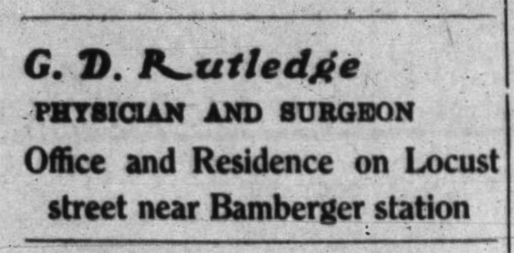 The advertisement above was placed in the Kaysville Reflex newspaper in the summer of 1913. That same newspaper recorded in November of 1916 recorded that the doctor was about to move his office and residence to the “Transeau” property on Tenth Street, one block north of the Bamberger Depot.” One block north would have been 100 North Street, so you can see that the names of roads have changed over time. (DRJ)
 (KFHM) (HM)
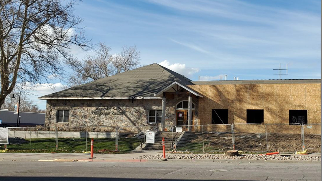
Blood – Davis – Gailey Home
 West at 55 East Center was located the home originally belonging to John H. Blood* it was built in 1901 of brick kilned in the Kaysville Brickyard on 200 North. Five years after the home was constructed, it was purchased by Edward Davis. Later, his daughter Mary and her husband Heber C. Gailey bought the home, having decided to move uptown from west Kaysville. Their son, Heber J., purchased the home from them around 1938. (DCC DUP)
The upstairs was used by the Independent Telephone Company during its existence from 1909-1911. Gray siding was added to the exterior of the home to cover the thick walls constructed with brick three deep. The building was purchased by Kaysville City in 2009.
 Heber’s wife Mirla used to do community canning in the old building that stood directly behind the home. Trailers loaded with vegetables were delivered here. All types of vegetables were left for her to can for just 7 cents a can. The small canning building was blown down by an east wind, but the building was the subject of one of LeConte Stewart’s paintings. (KTN)
(KFHM) (HM)
Creamery – Morton Home/Hospital – Kershaw Home
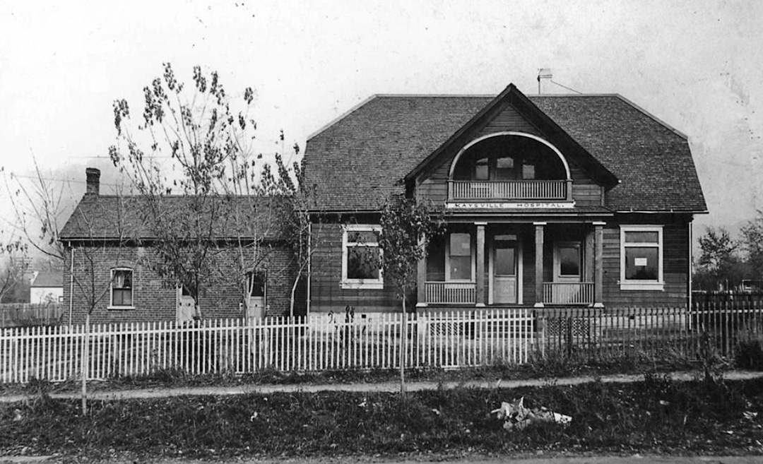 Next was a large two-story building which had been Seth Jones’ creamery on Cherry Street (46 East 200 North) but was moved south to 45 East Locust, later known as Center Street. To accomplish this task, it was pulled by mules with logs beneath to act as rollers. Here it became the home of Doctor John Edwin Morton and family. In 1907, this became the first hospital in Davis County and it served as a hospital off and on until 1920. All the equipment for this hospital was purchased from Grace Hospital in Salt Lake City. After Doctor Morton moved to Roosevelt about 1917, he sold the building to Frank Williams, and then son-in-law Fred Kershaw bought it. It was torn down in 1978. (DCC DUP) (KOT)
 The older adobe home was onsite at the time the creamery was moved. It was attached to the west side of the larger two-story home. The original owner was Samuel Layton who had the home built in the 1870s. Morton lived here for a short time before moving into the hospital building.
 (HM) (KFHM)
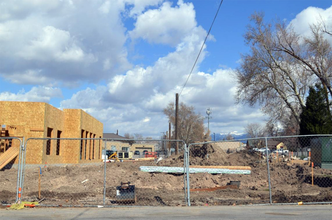
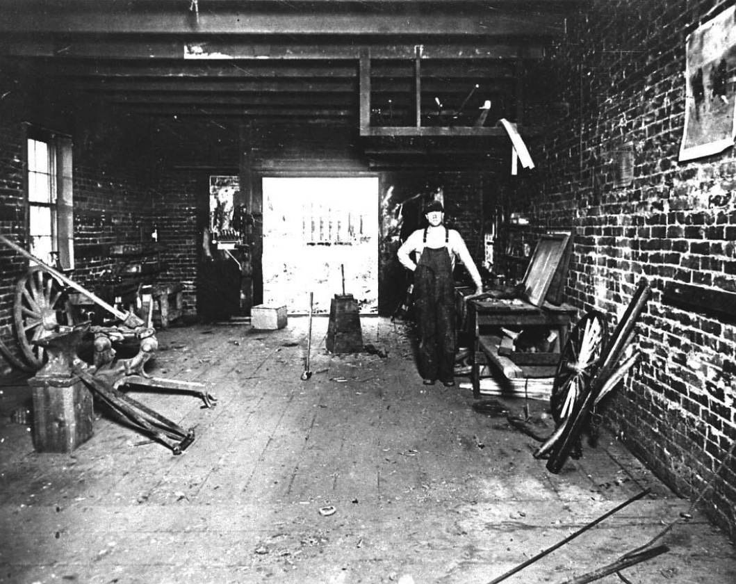
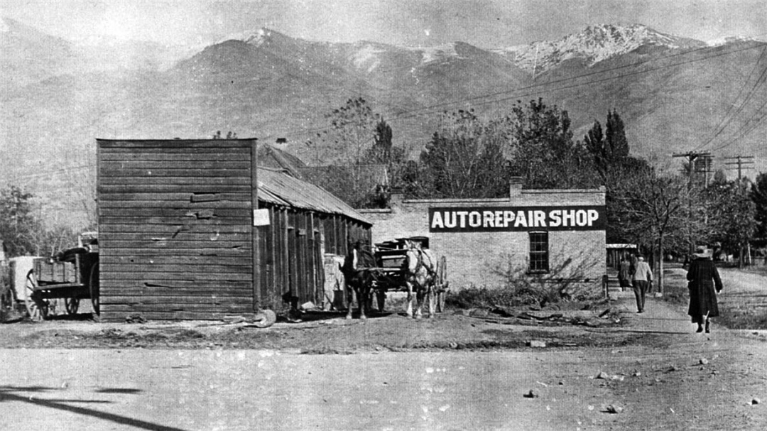
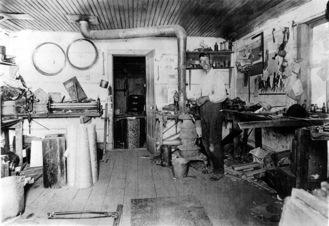
Blacksmith Shop /Auto Repair Shop / Library / Fire Station / LeConte Stewart Gallery
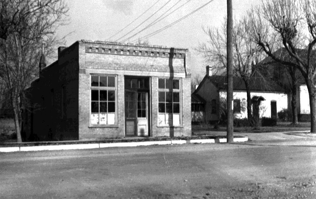 Next door west was the LeConte Stewart Gallery of Art, in a building which was once a blacksmith shop. Here we see the City Municipal Building, but before its erection in 1985-6, the little building standing at this location had an interesting history. Built in 1912 as a blacksmith shop by John Owen, it became a meeting place for men while their horses were being shod. The next smith was a Mr. White who added a lean-to shop for the Jayson Harness Shop. When automobiles became more numerous, it became an auto repair shop, then in 1921 a library – the first in Davis County. The address has variously been known for some reason as either 11 or 26 East.
 Next it was the city fire station until 1969 when a new station on 100 East and 100 North was completed. In 1971, it was painted and renovated and became the LeConte Stewart Gallery of Art, honoring our well-known artist. It was painted white, covering the sign and the entrance to the gallery was on the west side of the building.
 (HM) (KFHM)
KCMI Shed / Service Station / Kaysville City Building
 On the northeast corner of Main and Center Streets, a wagon shop was found drawn on the Fireman’s Insurance Map of Kaysville 1894, the original map now held in the Library of Congress. Its location was west of the blacksmith shop, where the city building now sits with the entrance on Center Street. Rather than a wagon shop, the building was actually the Kaysville Cooperative Mercantile Institution (KCMI) coal shed.
The confusion between wagon and coal may have come from the fact that individual wagons would be driven up, weighed on the scale on one side, and then filled with coal. At this point, the wagon would then be driven over to the other side of the scale and weighed again. This would allow the purchase price to be calculated and the transaction finalized.
The building was later a Shell Service Station, then later again remodeled as another gas station. More on these buildings will be included on a Main Street walking tour guide.
 (HM) (KFHM)
Patillo’s Tinsmith Home and Shop
 In what is now the Zions Bank east parking lot was a small shop belonging to George Fletcher Patillo’s tinsmith shop where he mended pans or buckets when they began to leak. Fletcher who came from Georgia was a first-class mechanic according to his obituary. In pioneer times when tin was the roofing material of choice, his “services were in demand in all parts of the county.” In old age, his skills were used mostly to repair household utensils.
He and his wife Esther produced the “earliest vegetables and the most luscious berries” in their garden.
 (HM) (BA) (KFHM)
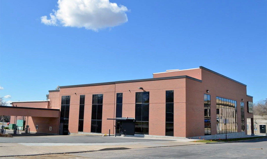
Horse Barn and Stables for Egbert Hotel / Second Barnes Bank / Zions Bank
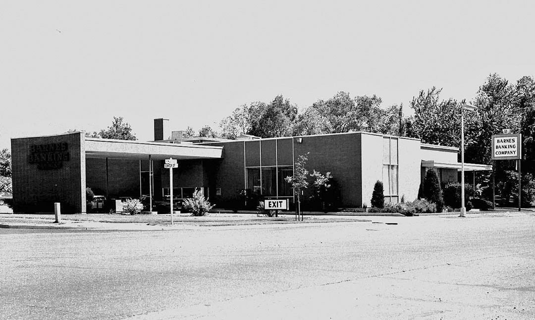 Where Zions Bank now stands was located the second Barnes Bank. Before the bank was built, there stood the horse barn and stables for the Egbert Hotel which was located across the street west. (DCC DUP)
Read more about the hotel, stables and bank in the Main Street walking tour.
 (KFHM) (HM)
Looking East
 Looking east from the corner of Main and Center Streets: This photograph dated circa 1915 was probably taken from a window of the Old Barnes Bank Building on the west side of Main Street. In 1853, Brigham Young sent instructions to the settlers of Kay’s Ward that because of potential problems with Native Americans, a fort of protection should be built. The east wall of that fort was to have been what is now designated Main Street. The men, however, were too busy trying to establish homes, gardens, farms and, in short, survive. The natives were not established in the area at the time of settlement, mostly passing through as travelers to other areas. Indeed, they presented little trouble for the most part and the men and women of Kaysville had more pressing matters to attend to than building a defensive fort. Only a small section of the wall was ever constructed, but the survey work benefited city planning with a well-laid out city block structure. (BA)
Sources and Credits:
BA – Bob Anderson photography and digitization of historical photos collected by Ivy and Alpheus Harvey and others
CEM – Columbia Elementary 3rd grade walking tour map circa 1975
DCC – DUP Page 1. Kaysville – Davis County Company Daughters of the Utah Pioneers Self-Guided Walking Tour – Center of Town. 1987
DG – The Kaysville Presbyterian Church 1888-1989 by Doneta Gatherum
DJW – Diary of Jane Wilkie Hooper Blood with additions by daughter.
DRJ – Davis Reflex-Journal Newspaper articles found on Newspapers.com
DS – Dedicatorial Services Kaysville Second Ward Chapel program. December 12, 1948.
Fold3 – Ancestry.com military records
FS – Individual Memories Photographs – courtesy of FamilySearch online
HM – Heritage Museum of Layton. Photos courtesy of Bill Sanders, Director
HMM – History of Merritt Agnes McLatchie Nance by Maud Odd
KFHM – Kaysville – Fruit Heights Museum of History and Art Photograph Collections
KLHS – Kaysville – Layton Historical Society publications
KOT – Page 193 Kaysville, Our Town Walking Tour by Carole Ivins Collett. 1976
KTN – Kaysville Historic Tour by Shirley Mills. In a Then and Now format, it was both printed and featured on the Kaysville City Website in 2008.
LR – Home a Surprise Buy for Couple. June 30, 1992. Lakeside Review, pg.2. / Kaysville Rental. April 6, 1993, pg.2.
LOC – Sanborn – Perris map Fireman’s Insurance, Davis County, Kaysville, July 1894. Library of Congress
Published by the Kaysville – Fruit Height Museum. Information compiled by Kristine Murdock, Bill Sanders and Fawn B. Morgan. April 2020.
 circa 1920 from the sidewalk of what is now Center Street. (HM)